
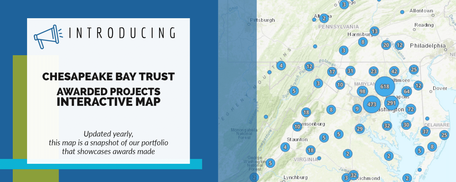
The Chesapeake Bay Trust is excited share with you our new interactive map that displays the awards we’ve made and provide a glance at our portfolio.
The map currently displays over 2,000 awards throughout the watersheds of the Chesapeake Bay, Maryland Coastal Bays, and Youghiogheny River. There are a variety of ways to interact with the map, and we hope that for whatever you’re interested in learning, the map has an answer. If you are interested in viewing projects only awarded in Maryland, or want to find awards funded by a specific source or partner, or want to search both of those aspects but also include awards with climate change as a project outcome, these are all possible using the map!
This map is interactive because we want users to learn more about the projects and acknowledge the people for which these projects wouldn’t be possible without—our grantees, partners, and donors. This map is a reflection of our collaboration, and we are proud of the work we’ve accomplished thus far and will accomplish together in the future.
See the map and learn more at https://cbtrust.org/impact-of-our-work/.
Please note that the map is not comprehensive of all awards made since the Trust’s inception, which means that some projects are not displayed.
We’ll be working on adding features, customizing the map, and more as we learn more about how the map can help us tell the story for the awards we make, communities we serve, and outcomes we realize together.
The Chesapeake Bay Trust updates and adds new projects to the map yearly, so stay tuned for more!